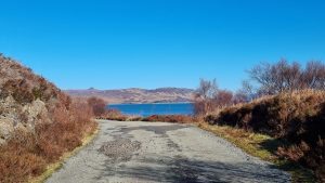
The Old Moll Road is a single track road which bypasses the A87 between Sconser and the lower end of Druim na Cleochd. It was always a quiet road on Skye but during a storm in September 2018 a huge chunk of the road was washed away. The road is unlikely to be repaired so it has become a bit of a peaceful walking haven. The landslip is closer to the Druim na Cleochd end so our walk starts at Sconser.
Parking at The Old Moll Road
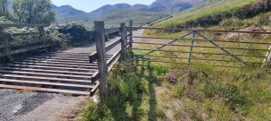
If heading to Portree on the A87 just before you enter Sconser take the turning to Moll on the right. If you are heading south to Broadford as you leave Sconser turn left to Moll just after the Isle of Skye Golf Club. You will see the Moll quarry up ahead. The road passes through the quarry. Be aware of large vehicles entering and leaving the quarry and continue through the stony area. As you cross the cattle grid there is an area to park a couple of vehicles on the right hand side. If this is full, just ahead on your left is another spot to park.
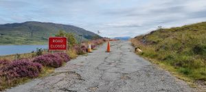
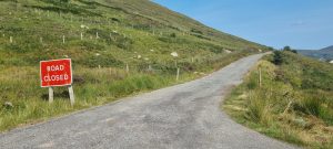
The road is signed Road Closed Ahead so although some vehicles do come down here they are few and far between. Most of the traffic for the fish farms uses the other end as they cannot access the fish farms from the Sconser end. It is here you start the walk.
Walking The Old Moll Road.
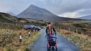
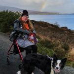
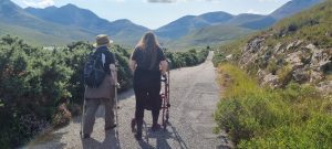
The surface of the Old Moll Road is fairly intact despite not having had any recent repairs done. There are a few huge potholes but they are easily avoided. With this in mind we would suggest that this walk is appropriate for anyone. Sarah walked with her rollator but it would be easy to push a wheelchair on, ride a mobility scooter on or even run, walk or jog! The initial part of the road is a slight incline. Nothing too steep but something to bear in mind. In fact the whole road is fairly level as it follows the counter of the hillside. It gently rises and falls but is never very steep.
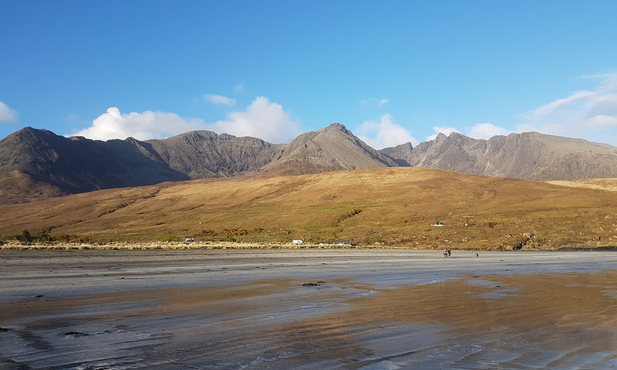
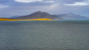
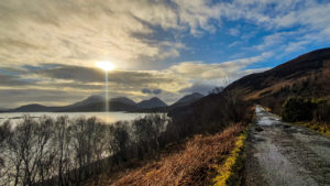
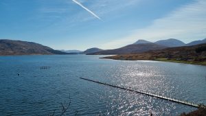
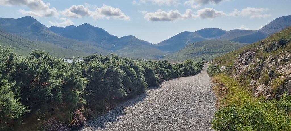
As you set off, the views up ahead are of Raasay and to your left The Braes and An Aird. Further in the distance you see the pyramid shape of Ben Tianavaig and in the distance the Trotternish Ridge. Ahead the road bends to the right and goes out of sight. Here the road levels off and you a rewarded with views across to Applecross. The road gently rises and falls, crossing small burns that run out to sea. On a sunny day the sea is aquamarine, a stark contrast to the heather and bracken. There is a lot of birdlife around the islands so maybe even take a pair of binoculars with you.
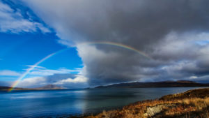
As we walked around the Old Moll Road we were treated to the sight of a rainbow. It was slow in appearing, but worth it in the end. First one end appeared over Dun Caan on Raasay. The the other end then appeared over The Braes on Skye. After about an hour both ends glowed and stretched right across the sky.
Distances
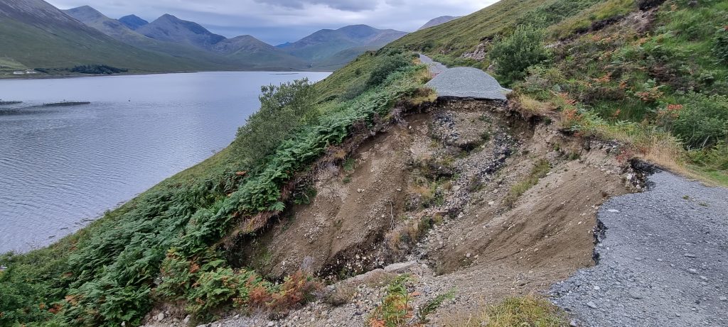
From the Sconser end of The Moll Road you can walk 3.7 miles until you reach the landslip. From the other end it is 2.6 miles until the landslip. The ground around the landslip isn’t particularly stable so I would not suggest trying to cross it. So basically you can achieve a total distance from one end of 7.4 miles and the other 5.2 miles. But bear in mind there is more traffic at the Druim na Cleochd side.
After half a mile or 0.8 km from Sconser you reach a bridge high above the Allt Darach. It was just after this point that Sarah and I stopped for a rest before heading back to the car. Walking about 1.3 miles or 2.2 km in total.
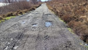
The day before I went out with one of my dogs and walked another 0.75 miles or 1.2 km round the road. The views down to Beinn na Callaich were gorgeous in the morning sun. The road surface is a little bit worse further round this side. It would be harder to dodge all the gravel and potholes in a wheelchair or mobility scooter here about. I don’t think it is impassable but just a bit trickier to deal with. 0.8 of a mile or 1.3 km from Sconser there is a bench on the road side with a view worthy of stopping for.
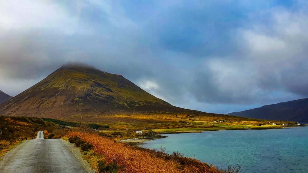
Take your time, go as far as you are able. Maybe even return another day and stretch yourself a little further. And, most definitely enjoy the view on the return leg. As Glamaig comes into view towering over Sconser it is a sight to behold.
Our return to the Old Moll Road
In early February 2021 we returned to the Old Moll Road together. This time we drove to the bench that Melanie previously walked past and parked there. This allowed Sarah to start the road walk a little further along and enjoy a new experience. As mentioned above the road surface gets worse further along here but it is still possible to negotiate around the potholes. It would actually be much harder for a car driver to avoid them! We didn’t bump into anyone whilst we were out walking this time. It was a bitterly cold day so it may get busier as the weather warms up.
Starting the walk from a different spot along the Old Moll Road meant that we enjoyed different views from our last visit. As we rounded the corner the snow capped Beinn Na Callaich made it particularly dramatic looking South. We still haven’t reach the landslip yet so there is still scope for further adventures to be had here. Here is the video of our chilly day on the Old Moll Road.
Our third visit to the Old Moll Road
We returned again to the Old Moll Road a few months later and drove to the point where we had stopped and turned back the last time. About 1km from the bench is a bit of waste ground on the right hand side where you can safely park. We were right about the road, walking it was easier than driving it. As we walked further we saw that the road surface got even worse. It is still passable though in places there is more pothole than road but Sarah could still navigate around with her rollator.
The road slowly turns through some trees to a more open south facing view towards Strollamus and Beinn na Callaich. A little more undulating than previously and definitely rougher. It was worth the effort though as walking another section of the road rewarded us with yet more stunning views. On this occasion we walked to another bridge, similar to the first one which spans a rocky crevice complete with waterfall. Up ahead the road dropped down quite sharply so we called it a day and headed back to the car. We were lucky enough to have a lovely, sunny day after several days of rain here on Skye so we once again returned to the bench for a little picnic. Here is a video of our third day on the Moll Road.
Our fourth visit to the Old Moll Road
On our return we, once again, parked up as near as we could to where we had finished the walk on our last visit and continued from there. We parked on a bit of scrub land just opposite the Mowi buildings on the loch side. The road now only serves a couple of cottages so there is little traffic and much more surviving tarmac. As with any unkept road there are many small, loose stones which makes the going more difficult for Sarah’s wheels. Melanie made a bit of a game upfront kicking them out of the way. But it really isn’t anywhere as near as bad the previous deep rutted section.
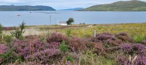
Once again, the reward for all these little inconveniences were the fantastic views. There was also a lot of flora and fauna for us to enjoy, including purple heather as far as the eye could see and a very large, very hairy caterpillar.
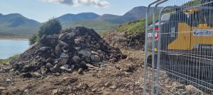
Just beyond the second cottage there is a road closed sign and the road is blocked off with a bit of rope. Melanie held down the rope with her foot so Sarah could get her wheels over it. From now on there are no vehicles on the road so the surface is much smoother. We passed a family of cyclists and their dogs enjoying the quiet space. With huge panoramic views spurring us on we carried on up to the landslip. And after seeing this, the largest hole on a road full of holes, we retraced our steps and returned to the car. Watch our Part 4 video here!
The Last Leg of The Old Moll Road
We headed out to finish walking the Old Moll Road this week with a spring in our step. We had met a lovely lady on Twitter who asked if she could join us on a walk when she was on holiday on Skye. How could we refuse!
We joined the Moll Road at the Loch Ainort end, the turning is just off the A87 on the loch side signed Moll and Road Ahead Closed. Find somewhere to park near the farm and Mowi buildings but do not block any gates, drives or field entrances. The walking from here is simple, follow the Old Moll Road as it rises above the loch. There is a rope to go over again but this didn’t cause any problems. No vehicles except a few maintenance ones have been on this section for nearly 3 years so the surface is in good condition.
The first thing you will come across is a cattle grid but the metal gate to the side swings open easily and allows safe passage around it. From there just walk as far as you wish and turn around when you are ready. The views are phenomenal in all directions.
A shout out to the workmen who had a huge digger on the road when we set off. We shimmied around the digger on the way out but on the way back they moved it out of our way. Not only did they do that but they also tried to smooth out the rough surface they had created with the massive metal bucket attachment. We were ever so grateful.
But that is us finished with the Old Moll Road now, slowly but surely a fully navigation of the road. Onwards and upwards to our next challenge.
Are their any pictures of the land slide ? Cheers Roy
Hi Roy, we have no photos of it as we haven’t yet been that far but if we do we will report on it
Hello,
At the end of May, we can finally start our cycle tour “Around Scotland”?
Skye was also mentioned to cycle along. Unfortunately, I saw that there was or is a roadblock at The Old Moll Road, a route with an amazing view!
I would like to be informed if this interruption is being or has been repaired? I would hate to have to take the big (dangerous) route as an alternative.
But please also tell me, if it is not yet passable, is there a possibility to pass it with the bike in hand?
I would like to hear from you.
Maybe we’ll see you soon. Thanks a lot!
(Do I get an answer via e-mail?)
Guido
Hi Guido this is not something that we have done but we have seen other people do it. Whether it is safe or not is not for us to judge without having done it. On the landward side of the landslip is a trodden area where people have walked around, but after our very wet winter this ground may have moved again. We haven’t been down there this year so can’t say what the current state of the path is. It is definitely not passable on the seaward side.
Hello all, I’m staying for a week in the little white cottage you have pictured, just before the road closed sign.
Today we walked along the closed section and got to the landslide. It’s even more devastating than the photo reflects! I was quite amazed at the size of the hoke and didn’t go near the edge at all as it just looks so unstable.
I assume that piece of road would be properly cordoned off if the council were worried though? It didn’t look like there was any way of walking around the edge to get past, in my opinion… but then I’m a scaredy cat ha!