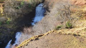
Lealt Waterfalls are located on the A885, 13 miles north of Portree. In 2018 the Staffin Community Trust heavily invested in the Lealt Falls area, adding new car parking and a viewing platform. This has been a welcome addition to the Trotternish Peninsula and also makes the view of Lealt Falls very accessible.
Lealt Waterfalls

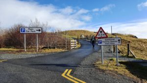
The entrance and exit at Lealt Waterfalls are part of a one way system. As you enter from the main road there are disabled parking spaces immediately on your left. The sign is on the fence rather than painted on the floor so is not so obvious. On the right is parking for coaches and minibuses. Up ahead is the main car park for all other vehicles, there is a maximum height of 2 metres for vehicles using the car park area. Within the car park is a picnic area which is accessible via steps or a slope. The pedestrian exits of the car park are through wooden kissing gates so not accessible for wheelchair users. You really need to be occupying the disabled parking spaces as you first enter from the road.
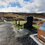
To access the Lealt Waterfalls viewing platform from the disabled parking spaces simply cross over to the right hand side. Take a lot of care crossing over as vehicles are constantly pulling in off the road. This is the only place you might feel vulnerable if you move quite slowly. Go up the slope ahead of you and the ground levels out. To your right are some information boards about the area and ahead the viewing platform. There is good grip underfoot and plenty of handholds if you feel unsteady. If you don’t like heights it may feel a little exposed but it is perfectly sturdy. This from a woman who gets dizzy standing on a chair!!
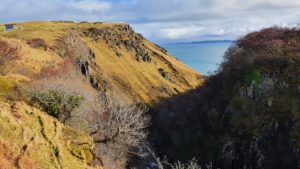
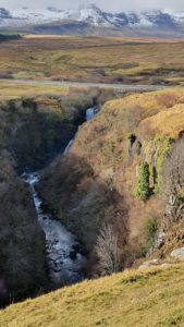
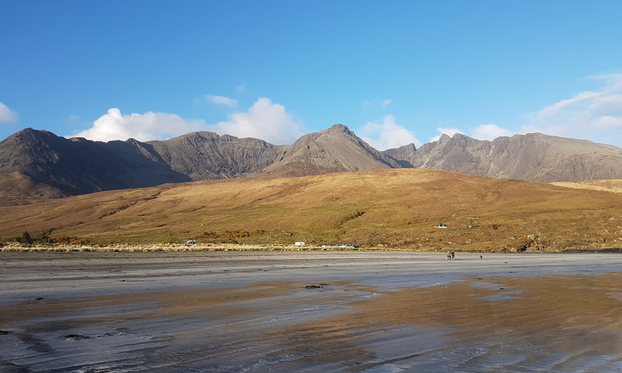
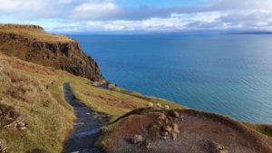
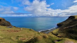
If there has been recent rainfall the falls are very impressive. The River Lealt or Abhainn an Lethuillt to give it the Gaelic name travels the Trotternish ridge to the sea. Crashing deep through Lealt Gorge and over a series of falls it is often orange in colour due to the surrounding peat. Whilst looking down at the falls ensure you look up and around you, the scenery is stunning. The Trotternish ridge dominates the skyline inland, whilst out to sea you look over Raasay to the mainland. If you are in a wheelchair this is about as fair as you can go I’m afraid. We ventured a little further with Sarah and her rollator but it was tricky.
The Path to the Invertote viewpoint
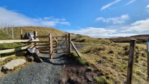
The path heads along the gorge towards the sea. It is a compacted gravel surface with one very steep but short descent and ascent close to the viewpoint. If it is quiet you might be better walking through the car park, although it is not often quiet here. Your first obstacle is a kissing gate. We folded Sarah’s rollator and I carried it through whilst she followed with her stick. A small hurdle but not insurmountable.
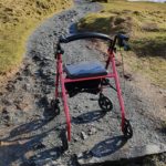
Now the path slowly inclines, still a good surface but with a few rocks sticking up to get in your way. I had to help Sarah unjam her front wheels a few times here. Due to the uphill nature of the path we also had a few rest stops along the way. Slowly but surely we reached a short stretch of fence at the gorge edge. Here the views are spectacular. From the car to the viewing platform, up to the fence and back to the car is approximately one third of a mile or 0.5 km distance. So although not very far it was quite tough for Sarah.
I carried on a bit further until the path levelled out. On the top here you find deep, wide rain gullies cross the path, so if you can stride over them you will be ok. This path continues to the top of some steep downhill steps to the Invertote viewing area. Now you can decide how much further you want to go. Able bodied people should not find it too difficult although you may feel a bit rosey cheeked on the way back up. For less able people it might prove to be difficult if not impossible. If you have got this far have a look and see for yourself. At least you have had some amazing views even if you can’t make it down.
Invertote History
The Lealt Valley Diatomite Railway was a 2 ft (610 mm) narrow gauge tramway which ran parallel with the River Lealt. Work started on the tramway in March 1889. At the grand opening the line was worked by gravity, the line being on a falling gradient, and manpower. Later, the line acquired the use of a steam locomotive.
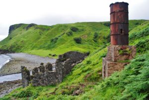
The west end of the line was at Loch Cuithir, where diatomite was extracted. Known locally as Cailc (Scottish Gaelic for chalk) it was put out to dry on wire nets. The seaward terminus had warehouses on the clifftop at Invertote. At the base of the cliff was a factory where the diatomite was kiln dried, ground and calcined. The line was extended from the factory onto a pier into the Sound of Raasay. Diatomite was also extracted from Loch Valerain and transported by aerial ropeway to Staffin Bay. During its existence, the Skye Diatomite Company extracted 2000 tons of diatomite.
From Invertote, the diatomite was transferred by skiff, onto puffer boats, waiting in the bay, and shipped across to the mainland. The diatomite was converted into kieselguhr which was mixed with nitroglycerine by Nobel Industries, at Ardeer, to make dynamite.
Looking down from the Invertote viewing area you will see the remains of some of these industrial buildings. It is now quite strange to imagine this now quiet area was once a bustling industrial hub.