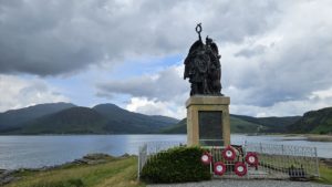
We arrived in Glenelg via The Original Glenelg to Skye Ferry and had a lot of exploring ahead of us. If you are only visiting for the day leave yourself plenty of time as there is a lot to explore here. And the most fun fact about Glenelg is…Glenelg Twinned with Mars. Yes you read that correctly…Mars!
Bernera Beach
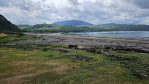
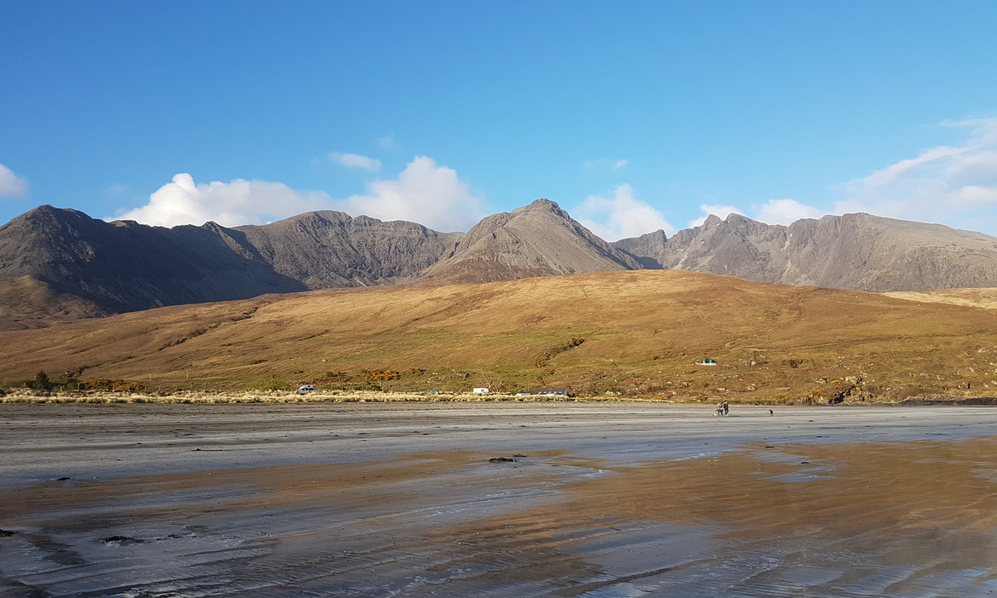
Our first stop after we’d had coffee and cake at The Shore Station was Bernera Beach. Just a short drive over the hill from the ferry. At low tide there is an expanse of sand and it is relatively easy to get to. You will find a small car park on the right hand side of the road with a 2 metre height barrier. Park here and the beach is right in front of you.
Cross a little bit of grass first, then some shingle and finally you are on the beach. Sarah managed with just her sticks and in no time we were on the sand. The views down the Sound of Sleat were phenomenal. For any avid bird watchers, take a moment to study the shoreline for a myriad of waders and sea birds. We also spent some time admiring all the coloured and patterned stones on the beach.
Glenelg Community Centre
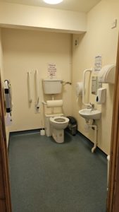
Our next stop was the Glenelg Community Centre. This is on the left as you drive into Glenelg. If you are looking for the disabled parking spaces, there are on the far side of the hall. Ignore the car park, drive past the lay-by in front of the hall and park at the far side. Here there are two designated disabled parking spaces and a dropped kerb to the hall entrance. Inside the hall are public toilets, up-kept by the community so please leave a donation if you use them. The disabled toilet is on the right as you go through the door.
There is a community cafe in the hall, Ruth’s Cafe. We had brought a picnic with us so didn’t go in but there are more details on their Facebook Page. Another eaterie you may want to look into is the Glenelg Inn, again we didn’t visit this time but check their website for information.
Bernera Barracks
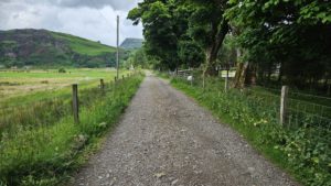
Opposite the Community Hall take the track towards Galtair 700m. This track is predominately a driveway for a handful of private houses. It is a good surface and carries little traffic. At the last house the path takes a left turn onto a grassy track and leads to the ruins of the Bernera Barracks. Bernera Barracks were constructed between 1717 and 1723 to subdue the local population following the Jacobite uprising. Some of the stones used to build them were taken from the Glenelg Brochs, which we visited later.
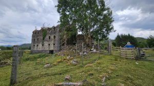
These tracks posed no problems for Sarah and her rollator. We imagine a wheelchair or mobility scooter would do well here too. For your safety the ruins are now behind a high fence but you can see them well and walk around the perimeter with no problems. When we visited there were sheep with lambs grazing around the barracks so be aware of this if you have dogs with you. Return the way you came once you have seen all you came to see.
The Glenelg Brochs
Carrying on our journey we headed to the Glenelg Brochs. These are just a further 3 miles out of Glenelg towards Arnisdale. Turn left at the bridge at the big sign for the Brochs, you are half way there.
Dun Telve
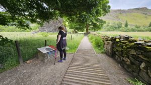
The first Broch, Dun Telve will be on your right. Park considerately in the large passing place/lay-by on the left. Carefully cross the road and go through the gate. It is a little steep off the road down to the gate so be careful here. A wheelchair user will probably need some assistance to navigate opening the gate and safely getting down the slope. The first part of the path to the information board is bumpy wooden slats, then just a gravel/rocky path. There are a couple of tree roots to wiggle around. It is only about 10-20 metres from the road.
Dun Troddan
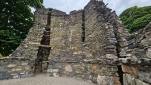
Once you have explored Dun Telve retrace your steps to the car and drive a little further up the glen to Dun Troddan. This Broch is situated on the left hand side a short way up a steep hill. Parking is again in a large passing place/lay-by. The start of the path is through a narrow kissing gate. The walk up to the Broch is much more challenging than we had anticipated. It is narrow, just the width of one foot in places, very steep and has loose stones. The path is much steeper in real life than the picture below shows.
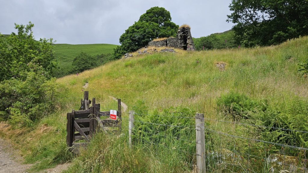
Because of this Melanie could not walk beside Sarah to assist her and instead walked behind her so she could steady her if she stumbled. This would certainly not be suitable for a wheelchair user or anyone who is quite unstable on their feet.
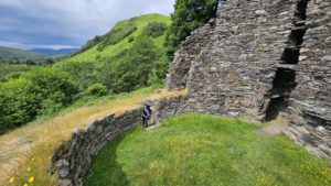
Dun Troddan Broch seems slightly shorter but better preserved. You can walk up a short section of the old staircase between the broch walls. From this vantage point you can look down into the broch and down the glen to Dun Telve. Considering their age both Brochs are in amazing condition. They give real insight into the lives of our forbearers. You will notice that both brochs are built with stones that look like the distinctive, pinky coloured stones we had noticed on the beach earlier.
Again it is just a case of retracing your steps once you have finished exploring the Broch and admiring the amazing scenery around it.
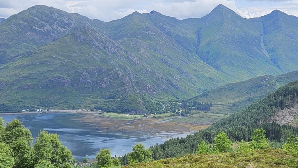
At this point if you had more time you could drive further towards Arnisdale. You will come to the Sandaig Islands and Camusfearna made famous by author Gavin Maxwell. We had run out of time so head back to Skye via Kyle of Lochalsh. This afforded us views of The Five Sisters of Kintail as we came over the Mam Ratagan Pass. A view not to be missed.
One Reply to “Glenelg”
Comments are closed.