Varragill River Walk

Views along the Varragill River

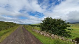
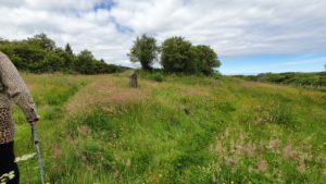
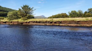
The Varragill River Walk is a quiet sanctuary close to the main road. A lovely river side path, popular with locals and dog walkers running alongside the Varragill River. It is not a path that is appropriate for wheelchair users as it is too narrow. However it can be navigated with a couple of walking sticks as Sarah did on our adventure.

Continue reading “Varragill River Walk”

St Columba’s Isle

According to a stone erected on St Columba’s Isle, it is the ancient burial ground and site of the Cathedral Church of the Bishop of the Isles from 1079 to 1498. Similarly ancient is the mortuary chapel of the Nicolson’s Aisle. Here according to tradition 28 chiefs of that clan are buried. Hidden away on the banks of the River Snizort it is a peaceful place, often missed by those whizzing along the main road between Dunvegan and Portree.

St Columba's Isle
St Columba’s Isle
Continue reading “St Columba’s Isle”

Glen Brittle Beach

Located at the end of Glen Brittle, the beach is one of the most beautiful on Skye especially when the tide is out. Glen Brittle beach lies in the shadow of the Black Cuillins which never fail to impress. With compact, endless sand it is a good walking surface to enjoy. Not a spot to bring a wheelchair but definitely accessible for everyone else.

Glen Brittle Beach
Glen Brittle Beach
Continue reading “Glen Brittle Beach”

The Nicolson Clan Memorial

Looking across Portree Harbour from the village there is a pristine piece of green land. Usually adorned with a flagpole which sadly broke in a early winter storm of 2020. This area is home to the Nicolson Clan Memorial. The walk from the village centre (Somerled Square) to the memorial is approximately 2.5km or 1.5 miles . Walking halfway on the footpath and halfway on the pathless Scorrybreac Road. Sarah found it quite tricky in places which we will describe at length below.

The view from the Nicolson Clan Memorial
Continue reading “The Nicolson Clan Memorial”

The Old Moll Road

The Old Moll Road is a single track road which bypasses the A87 between Sconser and the lower end of Druim na Cleochd. It was always a quiet road on Skye but during a storm in September 2018 a huge chunk of the road was washed away. The road is unlikely to be repaired so it has become a bit of a peaceful walking haven. The landslip is closer to the Druim na Cleochd end so our walk starts at Sconser.

View from the Old Moll Road
Continue reading “The Old Moll Road”

Glen Varragill Forest Walk

This Glen Varragill Forest Walk follows an old logging track which runs parallel to the A87 Sligachan to Portree. Heading North towards Portree from Sligachan the track starts approximately 4km or 2.5 miles up Glen Varragill on your left. The logging track starts at the A87 and bends down to the River Varragill crossing a bridge. There are a couple of parking spots immediately on your left at the top of the track.

Overhead view of the start of the Glen Varragil Forest Track
Continue reading “Glen Varragill Forest Walk”

Glamaig Waterfalls

Firstly the walk to Glamaig Waterfalls is not suitable for wheelchair users or rollator users. However it is a rewarding gentle walk of just under 2 km or 1.25 miles in old money! It is on a good path and very easy going. The Glamaig waterfalls walk would be perfect for anyone who is a little unfit or is looking to regain some fitness by starting with some gentle walks. Depending on how fast you walk it will take from about 40 minutes to go there and back. Maybe a little longer if you need to. Even after rain the path is a good surface to walk on, and the waterfall is even more spectacular. Don’t get this walk confused with the Allt Dearg Waterfalls on the opposite side of Glen Sligachan, we’ll cover that another time!

Glen Sligachan
Glen Sligachan
Continue reading “Glamaig Waterfalls”

The Lump in Portree

Portree is the capital of Skye with around 2500 residents. Dividing Portree’s waterfront is the rocky outcrop known as The Lump. Walking up The Lump in Portree will give you gorgeous panoramic views across the harbour, over Loch Portree, north to The Storr, south to The Cuillins and east to Raasay. It is well worth the walk up the steep slope for the views alone.

View from The Lump in Portree

There is also another path around The Lump in Portree called The Meall or Am Meall to use it’s Gaelic name. However this path caused us a lot of fun and difficulties. We definitely had an afternoon of two halves.

Let’s start with the difficult path, that way we end on a high!

Continue reading “The Lump in Portree”